 3. Rural Paths Tour
Length: between three and four hours.
Distance: around 12.5 kilometres.
Difficulty: none.
Recommendations:
1. You can do it either on foot or by bicycle.
The route starts in Rota, at the end of La Libertad Avenue, just at the roundabout which is at the entrance to Rota (A-2075 road). Rota is a coastal town whose inhabitants have traditionally worked in agriculture or “Mayetería” (as they name it) and fishing. Nowadays they are also engaged in tourism due to its beautiful beaches.
In the first part of the tour, we will pass by family vegetable gardens and agricultural fields. The natural paths are separated from the fields with brooms, black locusts, fennels and some eucalyptus trees. The path crosses two roads (A-491 and A-2077) and a steam by means of three bridges.
Near the end of the path, there is a huge abandoned silo. Then you will cross a paved path called “Hijuelo de la Tía Pepa” and you will continue the tour until you see “Costa Ballena”, a huge touristic complex surrounded by a golf course, Costa Ballena Ocean Golf Club, which belongs to the municipality of Rota.
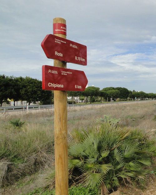
The Entre Ríos Nature Trail in Chipiona is reached by taking a detour at kilometre 4 of the road A-491, just in front of Costa Ballena urbanization, where it connects with the Rota Nature Trail.
After a first crossroads, you will arrive at Arroyo de los Majadales path.
Upon reaching the crossroads with Colada de Chapitel, on the bridge over the Arroyo del Barrancón, a wooded mass of stone pine is accompanied by a rich undergrowth with a multitude of typical Mediterranean forest species. In this pine forest, the Hermitage of the Virgen de Regla is placed, where you can rest on many benches and recreation areas.
After crossing the Colada de Puerto Romero, the kilometer milestones of the old railroad remind the railway history of Chipiona.


